
Join Our Mailing List
Sign up to receive updates on our latest news and events. Your email will never be shared or sold and you can opt out at any time.
No, I don't want to receive updates
Sign up to receive updates on our latest news and events. Your email will never be shared or sold and you can opt out at any time.
No, I don't want to receive updates
A copper-gold-silver-antimony exploration property spanning roughly 72.9 km² that anchors the western end of A.I.S. Resources' Lepreau District in Southwestern New Brunswick.
Pocologan anchors the western end of A.I.S. Resources' Lepreau District — an early-stage copper-gold-silver-antimony exploration property covering approximately 72.9 square kilometres in southwestern New Brunswick, Canada.
The project benefits from established regional infrastructure, including highways, rail, power, deep-water port facilities at Saint John, and a skilled regional workforce.
In keeping with the wider Lepreau District thesis, the Pocologan property is interpreted by the Company to have potential for iron oxide copper-gold (IOCG) or magmatic copper-gold style mineralization, alongside structurally controlled copper-silver-gold targets — the same family of styles interpreted across the district.
Historical compilation materials identify several areas of interest where prospecting reportedly identified copper, gold and silver mineralization associated with the gabbroic, granodioritic, altered and sheared host rocks that recur across the Lepreau District.
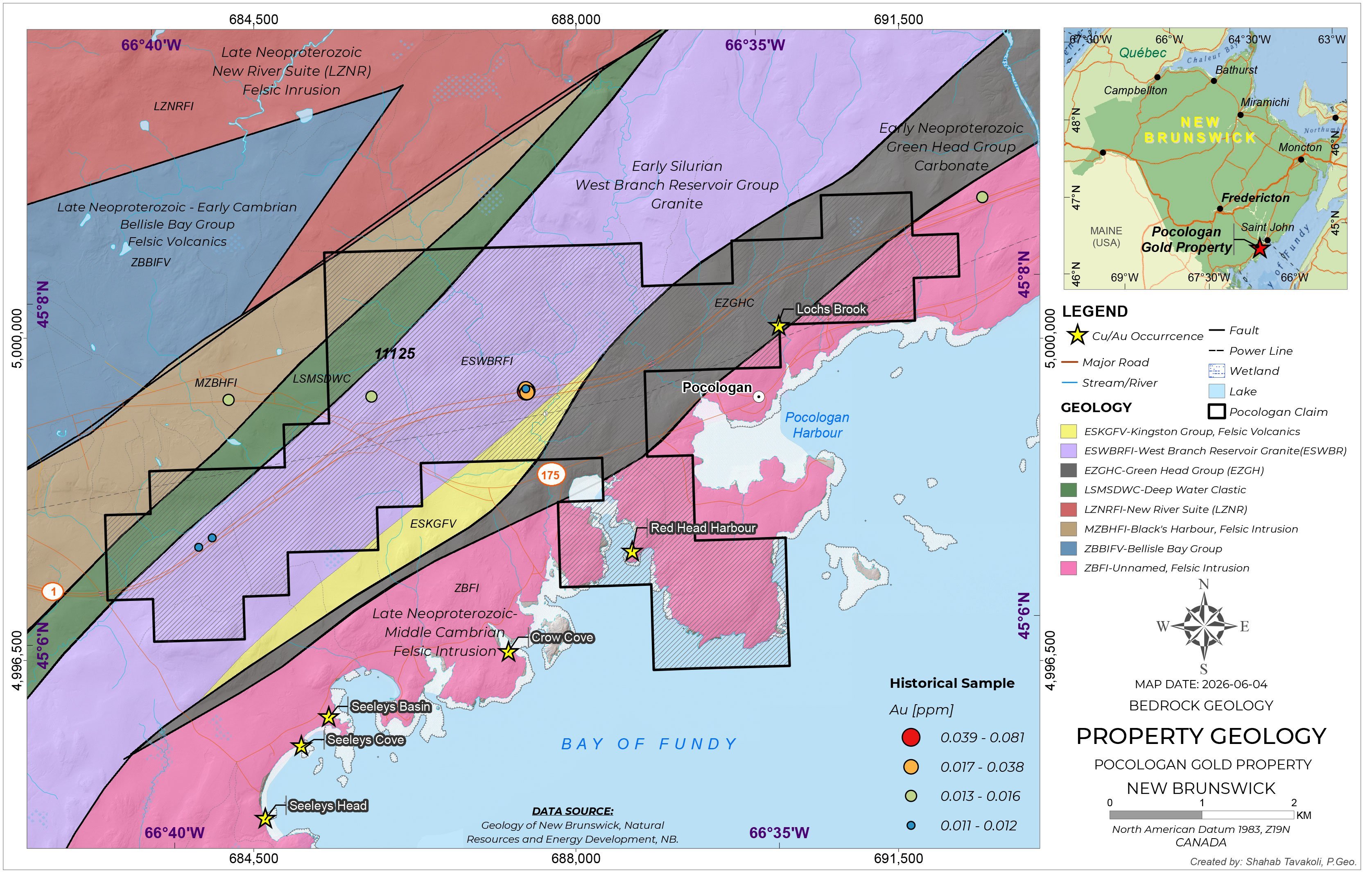
Historical prospecting reportedly identified copper, gold and silver mineralization associated with gabbroic, granodioritic, altered and sheared host rocks.
Identified in historical compilation materials as an area of interest for copper, gold and silver mineralization within the property.
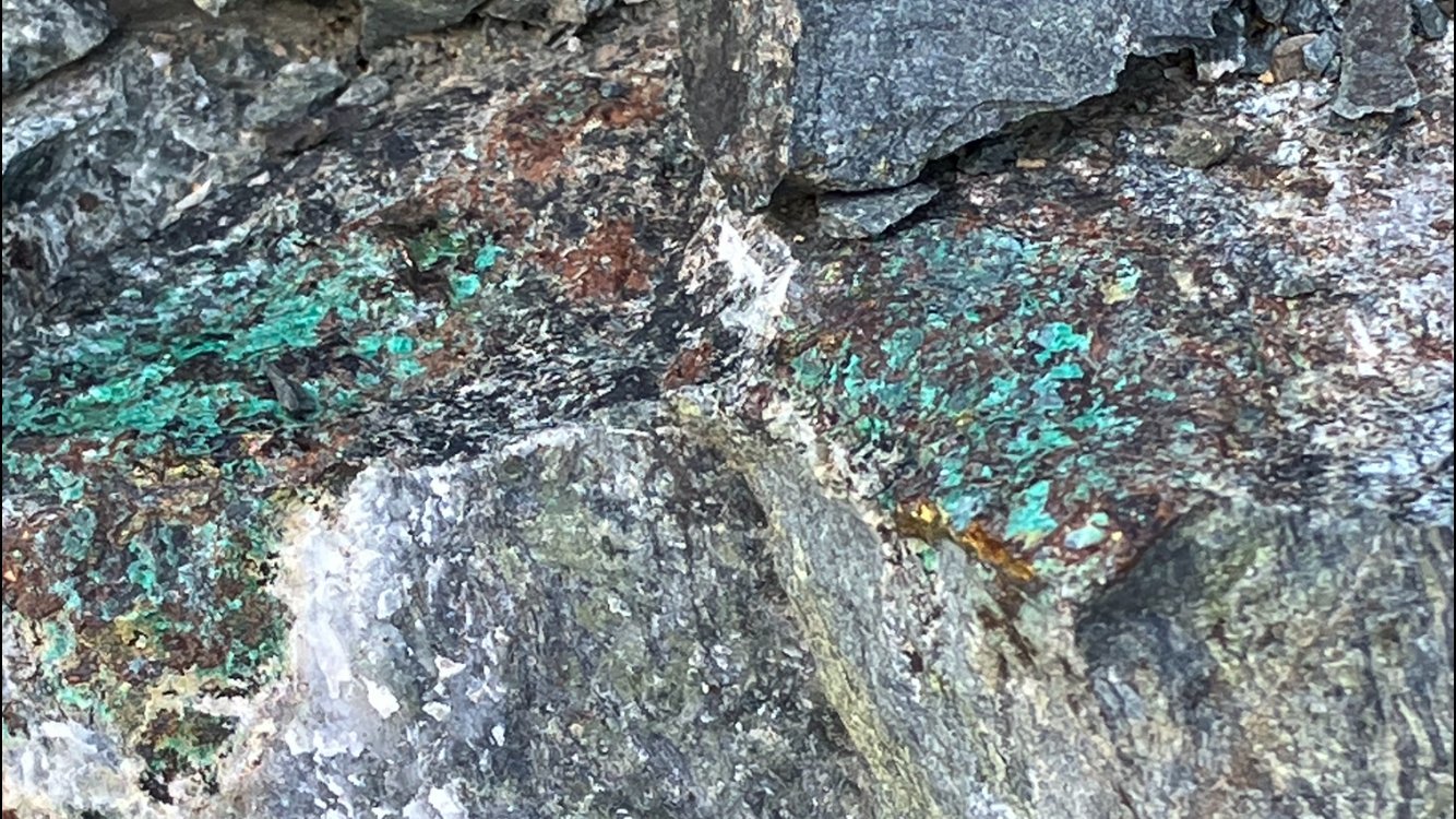
Copper mineralization and staining observed in outcrop at Pocologan. Photos: Marc Enright-Morin.
The Company recently completed a high-resolution airborne magnetic and VLF-EM geophysical survey over the Pocologan property. The helicopter-borne survey was completed by Geo Data Solutions GDS Inc. and designed to assist in mapping bedrock structures, lithological contacts, magnetic trends and potential conductive features relevant to future exploration targeting.
The geophysical information will be integrated with geological, geochemical and historical exploration data to support future prospecting, mapping, sampling and potential drill targeting.
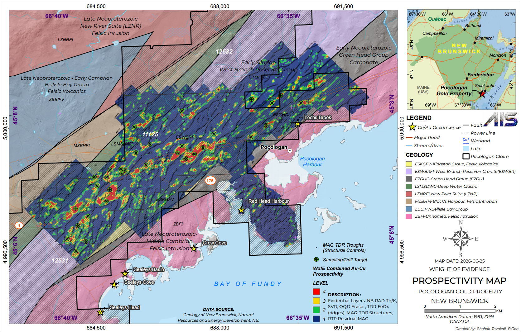
The Weight-of-Evidence prospectivity model, integrated with mapped copper-gold occurrences, highlights several target areas across the Pocologan claim block:
Highest-ranked prospectivity along the West Branch Reservoir / Bellisle Bay trend — the principal northeast–southwest combined Cu-Au corridor through the centre of the claim block, with Level 3–4 prospectivity and a dense target cluster.
Eastern Cu/Au occurrences flanking Pocologan Harbour — mapped copper-gold occurrences along the eastern part of the corridor, near Pocologan and Red Head Harbour, with direct coastal access.
Southern Cu/Au occurrences along the Bay of Fundy claim margin — 4 occurrences including Seeleys Basin, Seeleys Cove, Seeleys Head and Crow Cove, situated along a structural corridor.
MAG-TDR troughs and RTP residual MAG anomalies mapped across the block, interpreted as structural controls on mineralization that frame the ranked sampling and drill targets.
A.I.S. Resources plans to continue exploration activities at the Pocologan property, using the processed airborne survey data to refine targets and advance Pocologan in step with the broader Lepreau District program.
Investor Updates
Receive the latest news releases and corporate updates from AIS Resources Ltd. directly to your inbox.
We respect your privacy. Unsubscribe at any time.